We spend a lot of net time on preparedness - and that matters - but most of us got into
this hobby because radio is fun. Tonight is about the playground: the
bands, modes, places, and projects that make you want to turn the radio on.
Below is a tour of fun things to try, from local nets and park activations to digital
networks and listening projects that don't even require transmitting. If one of these
is new to you, consider it an invitation.
Ragchew and learn: there's a local net almost every night
If you like talking to people, southeast Michigan has you covered all week long. A quick sampler:
| When | Net | Where |
|---|
| Daily, 10:15 PM | Southeastern Michigan Traffic Net - old-school message handling | 146.760- (PL 100.0) |
| Weekday mornings | East Coast Reflector Morning Brew - coffee-and-radio social, 7-9 AM | 443.075+ (PL 123.0) |
| Sunday, 5:00 PM | Michigan ARPSC Net - statewide HF, linked locally on 147.200+ | 3.932 MHz |
| Monday, 7:00 PM | Double Nickel Net - pure social/ragchew | 443.550+ (PL 107.2) |
| Tuesday, 8:00 PM | East Coast Reflector Tech Net - two hours of technical Q&A | 443.075+ (PL 123.0) |
| Thursday, 8:30 PM | L'Anse Creuse ARC Net - right after our net wraps up | 147.080+ (PL 100.0) |
| Friday, 7:00 PM | Wayne County Repeater Crawl - one net that hops across multiple repeaters | Starts 145.330- |
| Friday, 8:00 PM | East Coast Reflector Youth Net - get the kids on the air | 443.075+ (PL 123.0) |
That's just a taste - see the full schedule with tones, sponsors, and websites on our
Other Local Nets page.
Parks on the Air (POTA): take the radio outside
What it is: POTA is an award program where "activators" set up portable
stations in registered parks and "hunters" work them from home. An activation counts when
you make at least 10 contacts from inside the park boundary. It's cheap, social, and a
great excuse to actually use that portable gear.
What qualifies as a park? POTA references are generally publicly accessible
lands managed for conservation or recreation - national and state parks, state forests and
game areas, recreation areas, wildlife refuges, and national/state trails. County and city
parks generally do NOT qualify unless they are part of a listed state/national system. Every
valid location has a reference number (like US-1234) in the POTA database.
Try it locally: Bald Mountain State Recreation Area (US-1397)
in Oakland County is a great first activation - easy parking, picnic areas for setting up,
and the elevation doesn't hurt your signal either. A wire antenna, a battery, and 10 contacts
and you've activated a park.
The W8CMN network: statewide infrastructure to explore
Thank you, Central Michigan Emergency Network! The W8CMN systems below are
built and maintained by the Central Michigan Emergency Network (CMEN) team. Their investment
in repeaters, linking, and digital infrastructure across Michigan gives all of us these
resources to use, learn on, and reference. We appreciate it - if you use these systems,
consider supporting them.

VHF Network
A linked system of VHF repeaters covering much of Michigan - check in from the car across huge distances without touching the dial.
w8cmn.net/vhf

UHF Network
The companion UHF linked system - great in urban areas and buildings where 70cm shines.
w8cmn.net/uhf

DMR
Digital Mobile Radio - commercial-grade digital voice with talkgroups that can connect you locally or worldwide. A $100 handheld gets you in.
w8cmn.net/dmr

P25
Project 25 - the digital standard used by public safety. Amateur P25 repeaters let you learn the same technology our served agencies use.
w8cmn.net/p25

MI7 Winlink
Michigan's Winlink infrastructure - email over radio with no internet required at your end. The same skill we practice for SETs is genuinely fun to play with.
w8cmn.net/mi7-winlink

APRS
Automatic Packet Reporting System - position beacons, short messages, weather stations, and telemetry on 144.390 MHz. Watch it all live at aprs.fi.
w8cmn.net/aprs
HF: which band when?
HF is where the world opens up. Propagation shifts through the day, but these are the
dependable hangouts:
- 80m (3.5-4.0 MHz) - evenings and nights. Regional rag-chews and nets, including the Michigan ARPSC Net on 3.932 MHz. Short-range NVIS coverage makes it the statewide workhorse after dark.
- 40m (7.0-7.3 MHz) - reliable almost any time. A few hundred miles by day, continent-wide at night. Arguably the most consistently useful band on HF.
- 20m (14.0-14.35 MHz) - the daytime DX band. Open from mid-morning through early evening for coast-to-coast and worldwide contacts. Most POTA activity lives around 14.285 SSB and 14.074 FT8.
- 17m/15m/10m - sunspot bonus bands. When solar conditions are up, these offer low-noise worldwide paths with modest antennas. 10m sometimes opens FM repeater-style fun too.
- Digital corner: FT8 (try 14.074 or 7.074 MHz) will get you contacts with 20 watts and a wire even when voice seems dead - a fun way to check what propagation is really doing.
For the listeners: scanning and monitoring projects
You don't have to transmit to have fun. A scanner or a cheap RTL-SDR dongle opens up a whole
world of listening:
Marine VHF Band
156-162 MHz carries boat-to-boat and boat-to-shore traffic on Lake St. Clair and
the Great Lakes. Channel 16 (156.800) is the hailing/distress channel - on a busy
summer weekend it's never quiet. You'll also hear freighter traffic working the
rivers and locks.
ADS-B: track aircraft yourself
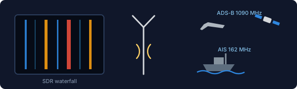
ADS-B (Automatic Dependent Surveillance-Broadcast) is how aircraft continuously
broadcast their position, altitude, and speed on 1090 MHz. With a $30 RTL-SDR
dongle and a small antenna you can receive it directly and plot every plane within
100+ miles on your own map - this is the data behind sites like
FlightAware and
ADS-B Exchange,
and you can even feed them and get a free premium account.
AIS: track ships the same way
AIS (Automatic Identification System) is the maritime cousin of ADS-B: vessels
broadcast their name, position, course, and cargo status on VHF (161.975/162.025 MHz).
Living next to Lake St. Clair and the shipping channel, we're in a perfect spot to
receive freighters directly and watch them move on a map - same RTL-SDR dongle works.
And more...
NOAA weather satellites (picture downloads with a V-dipole antenna), the ISS
(APRS digipeater and occasional SSTV image events), airband (118-137 MHz for
Selfridge and Detroit Metro traffic), and railroad channels around 160-161 MHz.
An RTL-SDR and free software unlocks all of it.
Pick one new thing
Check into an unfamiliar net, hunt one POTA station, try one W8CMN system, make one FT8
contact, or plot one freighter on your own AIS map. The hobby has a hundred doors -
tonight, tell us which one is your favorite, and maybe find your next one.